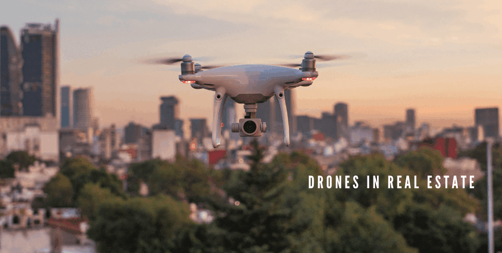
The real estate industry has always been driven by visual appeal. For decades, agents used still photography to represent the essence of a property, hoping to lure potential buyers with a few selective images. Today, much of that scene is a distant memory. Unmanned aerial vehicles, or drones, have taken to the stage with a view which used to be the domain of expensive helicopter flights and blockbuster film units. These are transformative devices that are changing the way properties are marketed, seen and managed.
The Marketing Revolution: Drones and Aerial Photography
Before drones became mainstream, taking aerial footage of a home was an expensive and cumbersome task. It required using a helicopter and hiring a professional photographer, an expense that most would not be able to make sense of for a plain old listing. Without drones, aerial imaging is very expensive to produce and upload, so until recently it was most commonly used by large developers or commercial real estate agencies that could afford the cost.
According to Jonathan Carcone, Founder & CEO of 4 Brothers Buy Houses, “Drones have revolutionized our ability to showcase our listings. Not only does it save us time, but it gives a buyer a much clearer view of what they’re considering when they can see an entire property and the surrounding in one uninterrupted shot. For out-of-state buyers, aerial imagery has been a game-changer, it makes virtual showings feel almost in person.”
Creating Stunning Visuals that Sell
The first and most transparent use case of drones in real estate is building up beautiful video content for marketing. Nice drone photography and videography can show a property in its full context in a way that ground-level cameras cannot.
- Showcasing the Entire Property: For big ranches, estates or even homes with a good sized portion of land attached to it, drones are able to profile an entire scope of this property. This allows buyers an actual feel for the grounds and how they sit in relation to the surrounding area.
- Highlighting Key Features: Your drone can showcase features such as a beautiful swimming pool, serpentine driveway, large back yard patio etc. Such dynamic images are more interesting than static shots and can help in conveying a lifestyle that comes with it.
- Contextualizing Location: Is the home a short walk from the beach? Does it back onto a beautiful golf course or a quiet park? Aerial footage can highlight these desirable proximity features, adding immense value to a listing. A drone can fly from the property to a nearby attraction, giving buyers a real-world sense of distance and convenience.
“Aerial shots allow us to communicate a property’s narrative in a visually gripping and authentic way,” says Pavel Khaykin, Founder of Pavel Buys Houses. Buyers now demand transparency, and want to see not just the house, but the world around it. Drones allow us to deliver that and drive better engagement to our listings.
The Rise of Cinematic Virtual Tours
The concept of a virtual tour is not new, but drones have taken it to another level. Instead of a clunky, point-and-click tour of a home’s interior, drones can create a seamless, cinematic journey. A drone can fly from the street, up the driveway, through the front door, and glide through each room of the house before exiting to the backyard.
This “one-take” video format is incredibly engaging and gives viewers the feeling of being on an actual walk-thru of a home. Paired with interior shots from a Steady Series™ camera, the end result is a professional-quality property tour that you can share on social media, listing sites or send direct to prospective buyers anywhere in the world. This feature was especially important at times when on-site viewings were restricted and the real estate industry came to a standstill.
Zack Moorin, Founder of Zack Buys Houses says, “What used to take several in-person showings can now be accomplished with a drone walkthrough. Our buyers love being able to ‘tour’ a home from anywhere especially when schedules or travel make visits difficult. It’s not just a COVID-era solution, it’s the future of real estate marketing.”
Beyond Marketing: Drones for Inspections and Management
It was beautiful imagery that first put drones in the real estate spotlight, but they are good for much more than marketing. And now drones are emerging as incredibly useful assets when it comes to the inspection, surveying and even ongoing operation of your premises in terms of costs, safety and efficiency.
Revolutionizing Roof Inspections
Traditional roof inspections are a risky and time consuming method. It took a professional to climb a ladder, walk across possibly unstable surfaces and check for signs of damage like missing shingles, cracks or leaks by hand. Not only was this dangerous, it could be slow and sometimes cause further damage.
Drones eliminate these challenges. The camera on even a high-resolution drone can produce vivid imagery of every angle of a roof shot in mere minutes. The operator can stay firmly on the ground while flying the drone to take a close-up look at chimneys, gutters and flashing. More advanced drones can also carry thermal cameras that spot hot or cold spots indicating poor insulation or secret moisture within the walls. This data gives an in-depth, fact-based evaluation of the roof’s health without anyone ever having to step a foot on the ground.
Francis Vierboom, Co-Founder of Propeller Aero explains, “Using drones for roof and exterior inspections has made our entire process faster, safer, and much less expensive. Instead of hiring multiple contractors or risking an accident, we capture everything in detail with one flyover. Sharing that footage with sellers and buyers builds trust and helps speed up deals.”
Efficiency in Land Surveying and Mapping
Surveying is essential for the development of real estate and for large properties. Current approaches require teams of surveyors on location, measuring distances and elevations with specialized equipment taking days or even weeks to cover larger areas.
A drone with GPS and photogrammetry software can do the same in several minutes. The drone flies a pre-planned grid pattern over the land, taking hundreds or thousands of overlapping images. This information is then used to generate extremely precise 3D models, topographic maps and property lines. This is not just quicker but more accurate than the traditional land surveying and offers the investors and developers with vital details required to make decisions.
Francis adds, “We’ve saved countless hours and avoided unnecessary costs by using drones for surveying and project planning. Whether it’s for acquisition or development, the data we get is detailed and actionable.”
Identifying Maintenance and Structural Issues
“Landlords and building inspectors are increasingly turning to drones as a way to help stay ahead of maintenance issues”, says Mike Otranto, Owner of Wake County Home Buyers. The exterior surfaces of a large commercial structure, multi-story apartment complex or industrial warehouse can be quickly inspected with a drone. It can raise red flags over cracked facades, failing mortar, damaged window seals and other structural issues that might not be visible from the ground.
“Property managers can get ahead of potential costly repairs with regular drone inspections. This preventative approach to maintenance can save money, increase the lifetime of the building and maintain tenant safety. The visual proof recorded by the drone camera is also crystal clear evidence for repair estimates, insurance claims and more”, adds Mike.
Routine drone inspections have helped us catch issues early and provide visual proof when negotiating repairs or insurance claims. It’s a huge advantage over the old way of doing things, and our clients appreciate that extra level of care.
The Practical Benefits: Cost, Speed, and Safety
The widespread adoption of drones in real estate is driven by three core benefits: cost reduction, increased efficiency, and improved safety.
- Cost-Effectiveness: Renting a helicopter for an aerial photo shoot can cost several thousand dollars an hour. A professional drone pilot shooting your property, on the other hand, is just a fraction of the cost. When it comes to inspections, drone use can replace the need for costly equipment such as scaffolding or lifts and decrease the man-hours needed.
- Efficiency and Speed: Away from the ground, a drone can scan 100 acres in less than an hour sitting down to work out where dogs are most likely to have gone missing. They would need a week in terrain that rough. A roof that used to take several hours is now done in 20-30 minutes. This type of speed enables real estate professionals to list properties faster, due diligence more quickly and manage properties more effectively.
- Enhanced Safety: This is maybe the greatest advantage. Drones prevent workers from being put in harm’s way. No climbing of ladders, work on steep roofs or hazardous construction environments. Using a drone as an extended set of eyes enables companies to decrease the likelihood of in-facility accidents and liabilities.
Challenges and Regulations
Despite their many benefits, using drones in real estate is not without its challenges. The primary hurdle for professionals is navigating the regulatory landscape. In the United States, the Federal Aviation Administration (FAA) governs the commercial use of drones. Pilots must be certified under the FAA’s Part 107 rule, which involves passing an aeronautical knowledge exam.
That said, there are a variety of limitations as to where and how drones can fly. Special waivers are needed to fly over people, in controlled airspace near airports, or outside the pilot’s visual line of sight. There are also privacy issues as pilots cannot film neighboring properties without consent. Compliance with these laws is essential for any real estate agent interested in taking their business to new heights using drones.
Mike advises, “Do your homework before taking a drone out for commercial use. The regulations are strict and for good reason, compliance is not optional, and neither is respecting others’ privacy.”
The Future of Drones in Real Estate
Drone use in real estate is positioned to grow even more. The applications will get more complex as technology evolves. Next-generation drones might have sophisticated sensors that can perform product analysis to identify detailed materials or gas leaks. Initial applications of AI will most likely involve the incorporation into drone software to instantly recognize and flag possible issues from inspection footage, providing an even smoother channel for their discovery.
Aside from technology replacing humans, we will likely see the development of fully autonomous drone inspections, meaning a drone could take off on its own, inspect a property and provide a report back without any human involvement. With the increasing adoption of virtual and augmented reality technology, the immersive drone tours of today will probably only become more interactive in the future; prospective buyers may be able to tailor a property virtually in ways we haven’t even considered yet.
From showing a home at its best angle to making sure a building remains structurally sound, drones have shown they are much more than just another trend. So, they are an incredibly versatile weapon which is revolutionising the way property professionals promote, view and maintain their properties. They save time and money, while also making dangerous tasks much safer; they deliver gorgeous visual displays in the blink of an eye. Drones are not just a new toy to play with, they’re a must-have tool to keep your business on equal footing with today’s real estate market.

Source: Drones in Real Estate: From Aerial Photography to Property Inspections